Zu alt zum Arbeiten, zu jung zum Sterben, gerade richtig zum Reisen. ...........................................................................Too old to work, too young to die, just right to travel.
July 31, 2017
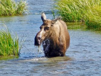
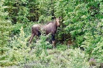
Today we traveled from Glennallen to Tok (224 km). The drive went first through a flat landscape with woods and a broad riverbed. Then it became more mountainous. It was a nice drive. There we saw a moose standing in shallow water as the picture shows. Moose like plants from the ground of such ponds. Since we were early in Tok we had enough time to wash clothes and do the necessary administrative works.
July 30, 2017
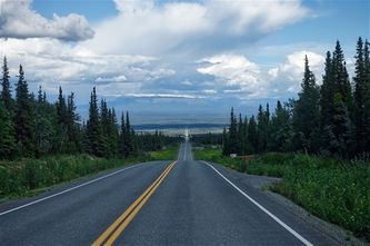
Today we planned to stay in Valdez. But it rained in the morning and the weather forecast did not promise better weather for the next days. Therefore we decided to leave Valdez and travel to Glennallen (190 km). The short travel gave us time to visit Valdez and a salmon river. At this time of the year, the salmons come back from the sea to spawn at their place of birth. It was very interesting to see how the salmons jumped up a little waterfall to reach their place of birth. Furthermore, we visited the Worthington Glacier on the way to Glennallen. I made the picture on the way between the Worthington Glacier and Glennallen at Tonsina.
July 29, 2017
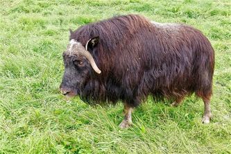
Today we traveled from Wasilla to Valdez In Alaska, USA (428 km). On the way, we visited a Musk Ox farm. These animals were once living in Alaska too but got extinct by overhunting. Since 50 years there runs a project to reintegrate these animals to Alaska. They started with some animals from Greenland. Then the way led through wonderful valleys with glaciers and mountains. The picture shows one of the Musk Ox at the farm we visited.
July 28, 2017
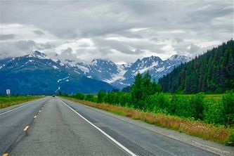
Today we traveled from Seward to Wasilla (266 km). The weather forecast announced a rainy day. The day was gray but it rained only a little bit. Since the clouds did hang very low there was not much to see as the picture from Moose Pass shows.
July 27, 2017
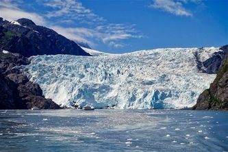
Today we attended a 7.5-hour cruise from Seward into the Kenai Fjord National Park. We visited two tidewater glaciers which calve little icebergs into the sea. The picture shows the Holgate Glacier. On the way to the glaciers, we saw Humpback Whales, Killer Whales, Sea Otters, Seals, Sea Lions, a Bald Eagle and other birds. The weather was quite good. Therefore this cruise was very nice.
July 26, 2017
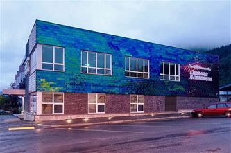
Today we traveled from Homer Spit to Seward (279 km). It was a gray and rainy day. However, in the evening in Seward, I found something colorful. The face of the Library and Museum building is covered with colored tiles which change the color when you pass by. I like such applications of color.
July 25, 2017
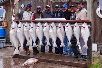
Today we stayed in Homer. Our campground is just at the end of the road. After that are some islands, the Kodiac Island and the Aleutians where no roads exist. But there live thousands of people. They are mostly Native people or Russian descents. They have to travel by boat or plane. Homer is the capital of Halibut fishing. The picture shows the catch of a group of man who chartered a fishing boat. I hope they know what to do with all this meat.
July 24, 2017
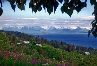
Today we traveled from Anchorage to Homer (356 km). With this, we reached the southwest most point of Alaska which is reachable on paved roads. The picture is made some miles before Homer and shows the port of Homer, the Kachemak Bay and the mountains of the Kachemak Bay State Park. From Homer, we could go to Kodiak Island or to some Aleutian Islands. For this, we would have to take a ferry or a plane.
July 23, 2017
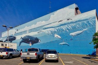
Today we had a lazy Sunday afternoon (like the song of the Small Faces). In the afternoon we visited Anchorage. There I found this huge wall painting at a JCPenny building as the picture shows. In the evening 4 Swiss couples were on the campground. We had a lot to talk.
July 22, 2017
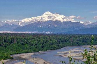
Today we traveled from Cantwell to Anchorage (340 km). Yesterday in the Denali National Park we didn't see Mount Denali (Mount McKinley) because it was behind clouds. But today on the way to Anchorage we had many nice views of Mount Denali like the one in the attached picture. Mount Denali is the highest mountain in North America. The South Peak has an altitude of 6194 meters or 20'320 feet.
July 21, 2017
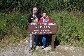
Today we did a bus tour into the Denali National Park. There is one road of 92.5 miles which goes into the National Park. We took the tour which went to the end point of this road. The tour took 12 hours. On the way, we saw beautiful landscaped and mountains. Furthermore, we saw more than 10 grizzly bears, many caribous, and two male moose. Unfortunately, the animals were all too far away for my camera. Therefore I post here a picture of us at the end of the road into the Denali National Park.
July 20, 2017
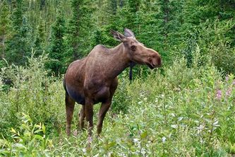
Today we decided not to go to Dead Horse. We couldn't find a transportation for a price we wanted to pay for. With this, our project to go as far north on the American continent is fulfilled. From now on we go south, as south as possible. The goal is Tierra del Fuego in Argentina. The road to there is called Panamericana. Today we traveled to the Denali National Park (209 km). We drove 12 miles into the park. This is the farthest point to which it is allowed to drive in with a private car. On the way back, I could take pictures of a moose cow from a distance of about 5 meters.
July 19, 2017
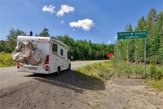
Today we traveled up north until the Dalton Highway as a gravel road starts (125 km) This is the most northern point we can drive on paved roads in North America. The latitude is about 65.5. This is not very north. When we were at the Nordkapp in Norway we were much more north (latitude of 71). Then we drove back to Fairbanks. We tried to find another way to drive up to Dead Horse. But we couldn't find anything affordable. The picture shows our RV at the beginning of the Dalton Highway.
July 18, 2017
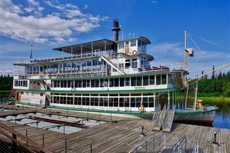
Today we stayed in Fairbanks. The rim is successfully repaired and the tire holds the pressure. We visited some tourist places as the Santa Claus House in North Pole, the River Cruise Paddle Wheel Boats on the Chena River and the Pioneer Park. The picture shows one of the Paddle Wheel Boats, which cruise on the Chena River.
July 17, 2017
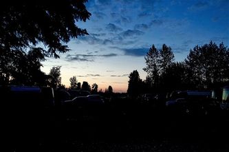
Today we stayed in Fairbanks, Alaska. We are here at a latitude of 64. At this latitude, the nights are never dark at this time of the year. The attached picture was taken at 2 am. When I got up in the morning one of our tires was flat. Since I have a spare wheel I changed the wheels. Then I went to a tire shop to let fix the tire. But they found out that the rim is cracked. But here they can't find such a European rim. Now a tire shop tries to weld the cracked rim. We'll see tomorrow if this was successful.
July 16, 2017
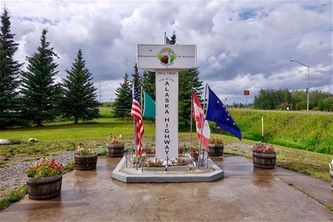
Today we traveled from Beaver Creek in Canada (Yukon) to Fairbanks in the USA (Alaska)(496 km). The crossing of the border was no problem. In Delta Junction, the Alaska Highway ended after 2288 km or 1422 miles. From here we traveled on the Richardson Highway for about 160 km to Fairbanks. The picture shows the End of the Alaska Highway Post in Delta Junction.
July 15, 2017
Today we traveled from Whitehorse to Beaver Creek (446 km). It was another rainy day. But today we saw a moose. They are very rare to see at day light.
July 14, 2017
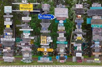
Today we traveled from Watson Lake to Whitehorse (441 km). It was another gray and rainy day. The sun came out only in the evening. In Watson Lake, there is a Sign Post Forest. A US soldier at the building of the Alaska Highway in 1942 was homesick and but a sign post up with the name of his hometown, the direction, and the distance. Over the years 85'000 people added their signs with the effect a sign post forest grew up. I even found a sign of my hometown St. Gallen. Therefore I had not to add another sign.
July 13, 2017
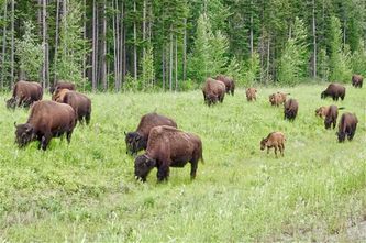
Today we traveled from Fort Nelson to Watson Lake (512 km). With this, we are now in the Yukon Territory. The day was mostly gray and rainy again. But we saw many animals. There was a deer, a bear, bighorn sheep, mountain goats, and bisons. All these animals we could see from our RV as the bisons in my picture.
Juli 12, 2017
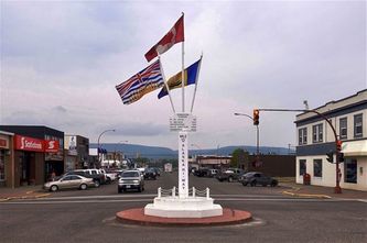
Today we traveled from Dawson Creek to Fort Nelson (454 km). It was another gray day and it rained most of the time. In Dawson Creek, the Alaska Highway starts. This road was built by the US-Army in 1942, 75 years ago. It was built to bring army stuff to Alaska because the US was afraid Japan would attack it. Later on, Canada made a highway out of it. The picture shows the Mile 0 Post of the Alaska Highway in Dawson Creek. The Alaska Highway is 2288 km or 1422 miles long.
July 11, 2017
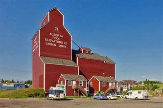
Today we traveled from Hinton to Dawson Creek (445 km). The sky was gray the whole day. We couldn't see the landscape, which should have been nice. In the evening the sun came out and I could shoot the picture of the wheat elevator in Dawson Creek, which is a museum today.
July 10, 2017
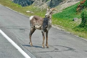
Today we traveled from Jasper to Hinton (100 km). We lost a lot of time since there were three bridges under repair. Each time we had a waiting time of about 20 minutes. And in Hinton, three gas stations didn't accept my credit card. Therefore we did overnight in a provincial park 20 km outside of Hinton. On the way to Hinton, a bighorn sheep was in the middle of the road. I had a hard time to brake in front of it. Then the bighorn sheep stayed at the side of the road and looked reproachful at me.
July 9, 2017
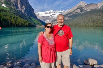
Today we traveled from Lake Louise to Jasper (232 km). We got up a 6 am to go up to Moraine Lake and Lake Louise to take pictures in the morning sun. Then we followed the Icefield Parkway on which we saw a lot of nice mountains, lakes, and glaciers. The picture shows Käthi and me at Lake Louise.
July 8, 2017
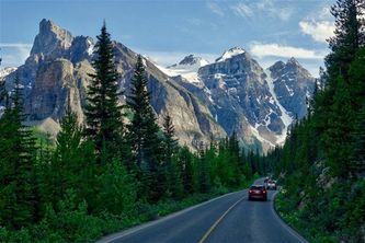
Today we said goodbye to Stefan and Edith. They return slowly to the USA. We start the next lap of our journey. The goal is Fairbanks in Alaska (3158 km or 1962 miles). I would like to go to Dead Horse at Prudhoe Bay. But the Dalton Highway from Fairbanks to Dead Horse is a dirt road. I heard about RVers, who came back with broken windshields and broken headlamp lenses. Therefore I don't do it with our RV. But I'll search a way to reach Dead Horse anyway. Today we traveled to Lake Louise (157 km) and visited Lake Louise again and Moraine Lake. The picture shows the mountains on the way to Moraine Lake.
July 7, 2017
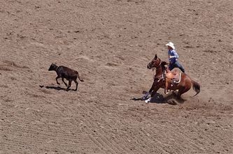
Today we attended a rodeo and other shows at the Calgary Stampede. The picture shows a tie-down roping scene of the rodeo show.
July 6, 2017
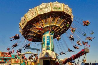
Today the Calgary Stampede started. It's the greatest outdoor show on earth. There are 10 days of rides, food stalls, sales booths, all kind of shows, music events, and rodeos. We went there and saw a horse and a dog show and many more things. The picture shows one of the many rides in the Stampede Park.
July 5, 2017
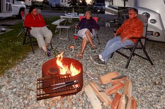
Today we chilled on the campground in Cochrane and did some chores. After dinner, we made a campfire, as we did several times from now on.
July 4, 2017
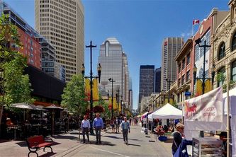
Today we visited Calgary. The picture shows 8th Avenue, which is a pedestrian street.
July 3, 2017
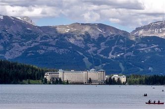
Today we visited places of Banff and Lake Louise. The picture shows the Fairmont Château Hotel at the Lake Louise.
July 2. 2017
Today we attended a show of the Canadian Cowgirls here in Cochrane.
July 1, 2017
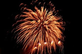
Today Canada celebrates its 150th anniversary. Our campground launched a big firework of about 20 minutes for this festivity. My picture shows one of the shots.
Kommentare
George
26.08.2017 08:23
Schön, wieder von Euch zu hören aus dem Land des unbedarften Präsidenten.
Neueste Kommentare
20.01 | 23:20
Hallo Mario,
Danke für deinen Kommentar. Ich denke oft an die Zeit mit dir in Lima. Uns geht es gut. Wir wohnen wieder in St. Gallen und können wegen Corona seit einem Jahr nicht mehr reisen. Bis bald
19.01 | 23:43
Hallo Erwin, wie geht es Dir und Katharina, ich hoffe gut. Bin nach langer Zeit in Deine Webseite gegangen und hier habt wirklich eine schöne Zeit als "Nomaden" verbracht. Wir bleiben in Kontakt.
26.09 | 11:47
Danke, dass euch unsere Band TEARS FOR BEERS am St.Gallerfest 2018 gefallen hat und wir es auf eure Homepage geschafft haben.
12.05 | 17:39
Danke für deine immer interessanten Berichte. Ich wünsche gutes Gelingen und einen starken Durchhaltewillen. En Gruess
Diese Seite teilen
